Tree walk Niederernen - Mühlebach
Open
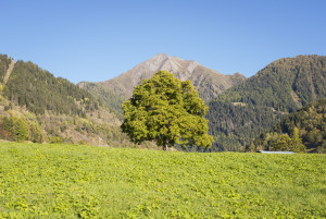
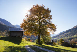
Discover the most impressive tree personalities around Ernen.
Theme trail
Time required: 1 hour 30 minutesLength: 4.88km

Parking days at Untergoms School
Learn more!
© Landschaftspark Binntal

Hiking trails are generally accessible paths that are usually intended for pedestrians. There are no specific requirements for walking on these paths. They are marked in yellow.
Mountain hiking trails are hiking trails that sometimes open up impassable terrain. They are predominantly steep and narrow and sometimes exposed. The signposts are yellow with white-red-white tips, confirmations and markings are white-red-white.
Alpine hiking trails are challenging paths. They sometimes lead through pathless terrain, over snowfields and glaciers, over scree slopes or through rock with short climbing sections. These trails require good equipment and very good surefootedness. The signposts are blue with white-blue-white tips, confirmations and markings are white-blue-white.
Stoneman Glaciara Hike: Following the success of the Stoneman Glaciara for mountain bikers, this variant is now an exclusive adventure for hikers and trail runners. Over 65 kilometers in length, 3,150 breathtaking meters in altitude, 2 valley-spanning suspension bridges, 1 spectacular ridge hike and the billions of tons of ice of the mightiest glacier in Central Europe - that's the Stoneman Glaciara Hike. You can find more information here.
Please note: Always close the gates on the hiking trails!
Discover the most impressive tree personalities around Ernen.
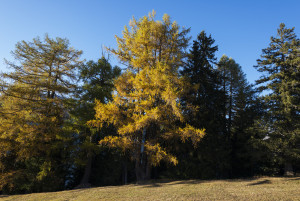
Discover the most impressive trees in the Wasen - Binnachra - Seng area
Discover the most impressive trees in the Wasen - Binnegga - Uf en Egga area.
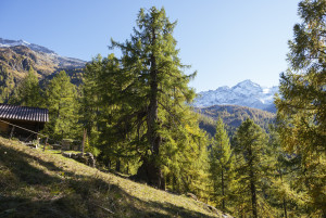
Discover the most impressive tree personalities around Binn.
On a few fields in Grengiols there is a wild tulip species, which does not grow anywhere else. Every year during the second half of May the village attracts many visitors who come to admire this special tulip.
Short hike from Wasen down to the beautiful Hockmatta and on to the picturesque Steinmatten.
The hike starts in the hamlet of Ze Binne and ascends from the reservoir up to Saflischmatta, where it's worth taking a break by the charming chapel.
Follow the marked hiking trail "Wilere" in the direction of the church. Once you arrive there, follow the hiking trail in the direction of "ze Binne".
The Z'Brigg group of buildings takes its name from the river crossing. The once important settlement on the Rottenbrücke is now reduced to a few buildings.