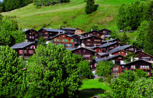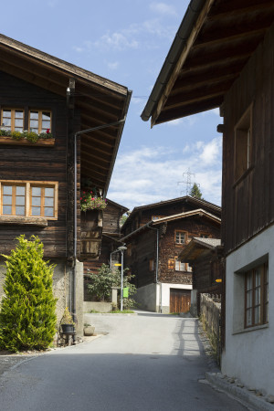
Mühlebach cultural trail
Open
Short circular hike through the idyllic village of Mühlebach
Hiking trail
Time required: 40 minutesLength: 1.50km

Parking days at Untergoms School
Learn more!
© Landschaftspark Binntal

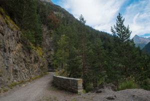
Hiking trails are generally accessible paths that are usually intended for pedestrians. There are no specific requirements for walking on these paths. They are marked in yellow.
Mountain hiking trails are hiking trails that sometimes open up impassable terrain. They are predominantly steep and narrow and sometimes exposed. The signposts are yellow with white-red-white tips, confirmations and markings are white-red-white.
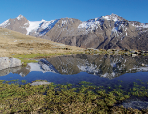
Alpine hiking trails are challenging paths. They sometimes lead through pathless terrain, over snowfields and glaciers, over scree slopes or through rock with short climbing sections. These trails require good equipment and very good surefootedness. The signposts are blue with white-blue-white tips, confirmations and markings are white-blue-white.
Stoneman Glaciara Hike: Following the success of the Stoneman Glaciara for mountain bikers, this variant is now an exclusive adventure for hikers and trail runners. Over 65 kilometers in length, 3,150 breathtaking meters in altitude, 2 valley-spanning suspension bridges, 1 spectacular ridge hike and the billions of tons of ice of the mightiest glacier in Central Europe - that's the Stoneman Glaciara Hike. You can find more information here.
Please note: Always close the gates on the hiking trails!
Short circular hike through the idyllic village of Mühlebach
From Mühlebach, you first descend below the road towards Steinhaus. Short sections also need to be covered on the road. Near Steinhaus, a bridge is crossed, and from there, the journey continues to Niederwald.
The hike begins in the village of Mühlebach and first ascends steeply until reaching the water conduit Trusera. The path then follows the water conduit to the Binnachra, and from there descends again to the Wasen.
This circular hike takes you from Niederernen up to Wasen. It offers a beautiful loop through the enchanted forest to Seng and back to Niederernen. The tour can easily be undertaken using public transportation.
This mountain hike starts in Reckingen, through the Blinnental to Ärnergale, and continues to Mühlebach.
At eleven stations, the rocks of the Binn Valley are presented, which shape the landscape of the valley. Experiential elements such as a lithopone, a boulder or the place with the small men of stones make the trail very varied, even for children.
The hiking trail starts in the minerals village of Binn and continues along the historical path through the wild romantic Twingischlucht gorge to the «auf dem Blatt» chapel. It then goes further past the picturesque hamlet of Hockmatta to Bächerhisch
Take the postbus to Mühlebach or Steinhaus or park in Steinhaus. The starting point is at the street gallery before Steinhaus. From there, the cultural trail leads back to the village of Steinhaus and on to the former hamlet of Richulschmatt.
Follow the former road through the Twingi gorge to the Santigläis junction. Here a hiking trail leads down to the equalising basin and then up to the settlement of Ze Binne.
Discover the most impressive tree personalities between Grengiols and Bister.