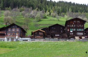
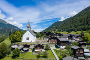
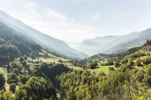
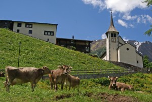
Summer hikes

The Binntal Landscape Park has an attractive network of walking, hiking and mountain trails. The hiking trail network consists of all the interconnected hiking, mountain and alpine trails. There are 3 different levels of difficulty in our area. These are marked with different colors.

Hiking trails are generally accessible paths that are usually intended for pedestrians. There are no specific requirements for walking on these paths. They are marked in yellow.

Mountain hiking trails are hiking trails that sometimes open up impassable terrain. They are predominantly steep and narrow and sometimes exposed. The signposts are yellow with white-red-white tips, confirmations and markings are white-red-white.

Alpine hiking trails are challenging paths. They sometimes lead through pathless terrain, over snowfields and glaciers, over scree slopes or through rock with short climbing sections. These trails require good equipment and very good surefootedness. The signposts are blue with white-blue-white tips, confirmations and markings are white-blue-white.

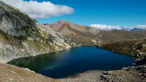
Stoneman Glaciara Hike: Following the success of the Stoneman Glaciara for mountain bikers, this variant is now an exclusive adventure for hikers and trail runners. Over 65 kilometers in length, 3,150 breathtaking meters in altitude, 2 valley-spanning suspension bridges, 1 spectacular ridge hike and the billions of tons of ice of the mightiest glacier in Central Europe - that's the Stoneman Glaciara Hike. You can find more information here.

Please note: Always close the gates on the hiking trails!

Show filter
  • List
  • Map
49 offers

Ausserbinn – Steinmatten

Open

The shortest route between Ausserbinn and Steinmatten is to take the motorway to "Lätze Üsserbi" and then continue on the hiking trail to the Steinmatten tunnel portal

Hiking trail
Time required: 40 minutesLength: 1.80km

Ausserbinn-Binnegga-Ernen

Open

A short but rewarding hike with views of the Rhone valley. A walk where you can soak up the sun and listen to the sound of the water.

Hiking trail
Time required: 1 hour 2 minutesLength: 3.65km

Ausserbinn-Römerbrücke-Hockmatta-Wasen-Binnegga-Ausserbinn

Currently partly closed

A charming circular route with detours into the Binna gorge. Highlights such as the old Roman bridge, picturesque hamlets bathed in sunshine and spectacular views of the Rhone Valley make this hike an unforgettable experience.

Hiking trail
Time required: 2 hours 32 minutesLength: 7.92km

Binn – Hockmatta – Wasen

Currently partly closed

We start off in the mineral village of Binn. The trial takes us to the hamlet of Zen Binnen, through the wild Twingi gorge, over the Roman bridge to the now uninhabited hamlet Hockmatta and after a small ascent into the Zauberwald.

Hiking trail
Time required: 2 hours 30 minutesLength: 9.00km

Binn - Blausee - Binn

Covered with snow

The hike starts from Binn through the hamlet of Wilere along the contemplation path into the Lengtal. Upon reaching Heiligkreuz, the path crosses three streams: the Chriegalpwasser, the Lengtalwasser, and the Saflischbach.

Hiking trail
Time required: 7 hours 30 minutesLength: 20.50km

Binn – Eggerhorn – Ausserbinn

Covered with snow

The steep hike is worth it. The Eggerhorn (2503m) is one of the most scenic points in the Binntal Landscape Park, alongside the Breithorn above Grengiols.

Hiking trail
Time required: 6 hoursLength: 15.04km

Binn – Giessen – Fäld – Binn

Open

From Binn, you hike to Giessen and then continue to Imfeld. Partly along the asphalt road, you return to Binn.

Hiking trail
Time required: 1 hour 35 minutesLength: 5.73km

Binn – Heiligkreuz – Binn

Open

From Binn, one first descends below Wilere to Ze Binne. From Ze Binne, the pilgrimage trail leads below the road to Heiligkreuz. The contemplation trail then leads above the road directly to Wilere and from there to Binn.

Theme trailHiking trail
Time required: 2 hours 15 minutesLength: 6.80km

Binn – Obers Meili – Sennenweg – Fäld

Closed

For those who enjoy hiking along steep slopes, the Sennenweg is the perfect choice. It runs along the north slope at an altitude of 2023 meters above sea level, crossing the Binntal valley all the way to Imfeld

Hiking trail
Time required: 3 hours 37 minutesLength: 9.47km

Binn – Saflischpass – Rosswald

Covered with snow

A long but unique hike that leads from Binn over the Saflisch Pass to Rosswald.

Hiking trail
Time required: 6 hours 17 minutesLength: 17.22km

The external booking tool is not barrier-free